-
Destinations

Top Destinations
Countries in Southern Africa
-
Our Private Tours
-
Safari Experiences
Popular Types
Safaris by Country
- Find a Trip
- About Us
- Start Planning
-
No visit to Southern Africa is complete without gazing upon the mighty Victoria Falls, one of the world's natural wonders and Africa's most popular attractions.
Share this on Social Media

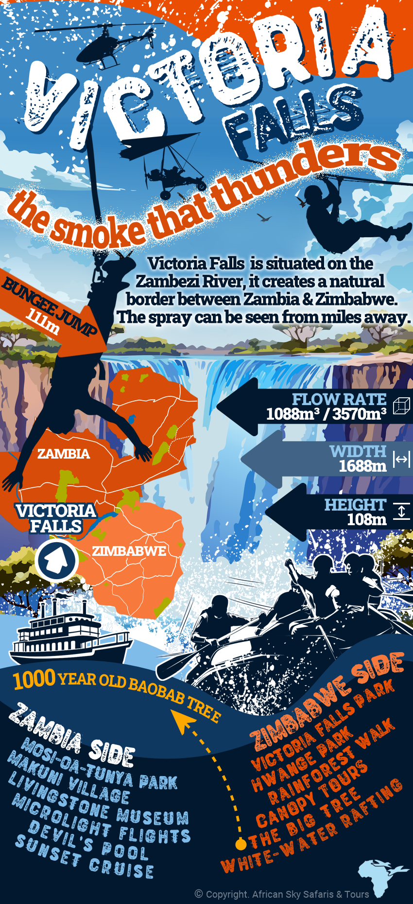
Victoria Falls is located in the Zambezi River between Zambia and Zimbabwe. The closest towns are Livingstone on the Zambian side and Victoria Falls on the Zimbabwean side. The waterfall is 1688m (5538 ft) wide and 108m (354 ft) high, with an average flow rate of 1088 and 3570 cubic meters per second. The spray cloud generated by the falls can be seen from many miles away, nourishing a rainforest adjacent to the falls.
Following the rainy season, the falls are most substantial between February and May; though awe-inspiring, the spray cloud could obstruct a clear view. From June to August, the water level in the river would normally have dropped, offering a clear view of the falls and great photographic opportunities. The river level from September to December can be low, with the falls reduced to a trickle of its maximum flow rate. At this time, experiences like swimming in the Devil's pool become possible.
In addition to viewing and photographing the falls, you could endeavor on a helicopter or microlight flight above the spectacle, enjoy a sunset cruise on the Zambezi River for the picture-perfect end to a day in Africa, or, if you are more adventurous, the stretch of river below the falls offers one of the best white water rafting experiences in the world. You could also opt for a bungee jump.
The information included in infographics on the www.africasky.com website serve as general knowledge when traveling to Southern Africa.


